Remote Sensing and Deep Learning:
Revolutionizing the ESG Landscape
In the ever-evolving landscape of Environmental, Social, and Governance (ESG) considerations, the integration of cutting-edge technologies plays a pivotal role in enhancing monitoring and reporting systems.
Remote sensing, a technology utilizing data from satellites and sensors, combined with deep learning algorithms, presents a powerful synergy with profound implications for ESG practices.
This intersection of technology is redefining how organizations approach environmental impact assessments, social responsibility metrics, and governance and compliance. The following insights delve into the transformative impact of combining remote sensing and deep learning in the ESG domain.
Environmental Impact Assessment
The combination
facilitates real-time
environmental impact
assessments,
empowering companies
to make informed
decisions for sustainable
practices, reducing
ecological footprints, and
meeting regulatory
standards.
Governance and Compliance
This synergy strengthens corporate governance, ensuring alignment with ESG standards, reducing environmental risks, and bolstering compliance, thereby enhancing overall corporate reputation.
Social Responsibility Metrics
Combining deep learning with remote sensing enhances ESG reports by adding precise social responsibility data, ensuring transparent corporate behavior, and nurturing community ties.
Predictive Analytics for Sustainable Practices
The application of predictive analytics optimizes resource management, supporting long-term sustainability goals, reducing waste, and improving overall operational efficiency.
ESG benchmarking
Enhances ESG benchmarking processes, allowing organizations to compare their performance against industry standards, leading to continuous improvement in sustainability practices and responsible business operations.
Our Solutions
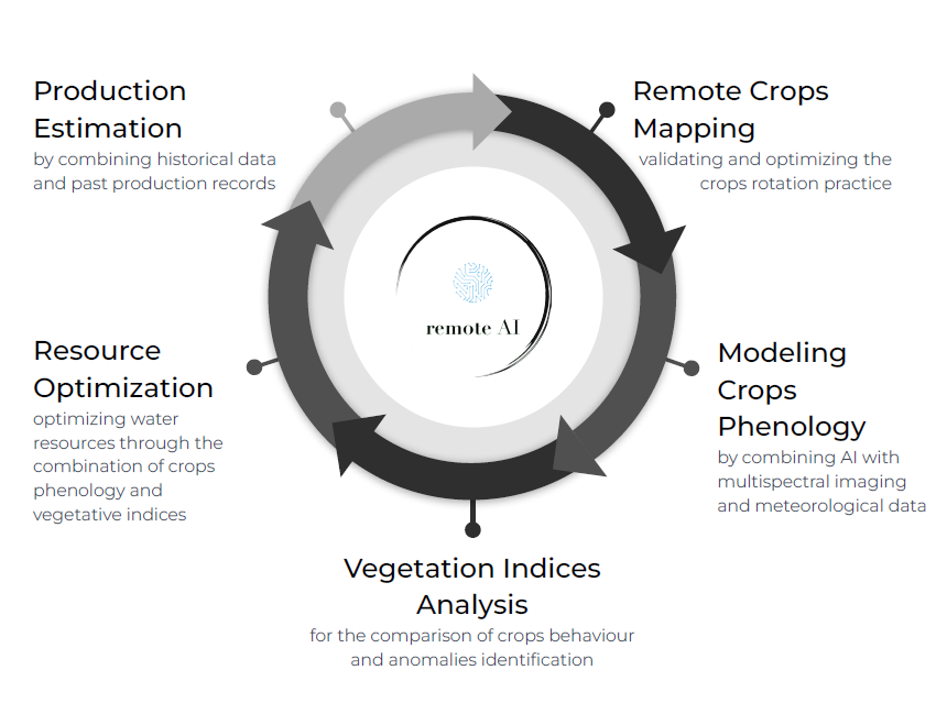
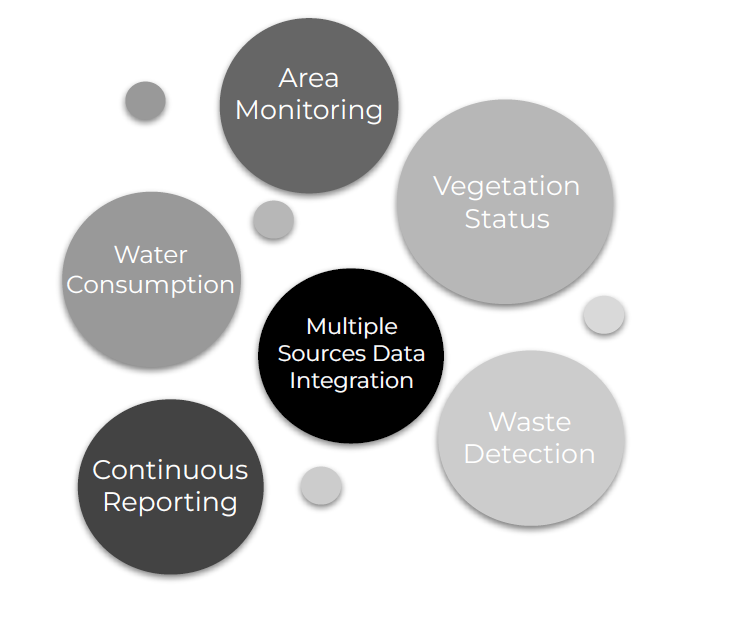
Our tailored services utilize comprehensive information from remote sensing data, ensuring a thorough analysis of environmental factors, land use, and vegetation health. Through the integration of deep learning data, we not only enhance crop yield but also estimate and mitigate the environmental impact of production activities.
Remote AI
Crops Mapping & Phenology Modeling
Vegetation Indices Analysis
Historical Data Analysis
Anomaly Detection & Continuous Monitoring
Decision Support
Resource Consumption Estimation
Case Studies
Applications in Cotton Farming
Understanding cotton phenology, the timing of its growth stages, is key to managing water use and maximizing yields. This knowledge, crucial in arid regions where cotton thrives, directly impacts water requirements, influencing flowering and fruiting stages.
Water usage increases initially, peaks mid-season, and decreases towards the end. Efficient water management, aligned with these phenological stages, is vital for sustainable agriculture, particularly for improving irrigation practices in cotton cultivation.

Applications in Animal Husbandry
Environmental impact assessments in animal husbandry are effectively conducted with multispectral and hyperspectral satellite imagery. These methods provide insights into breeding environment dynamics, especially in the textile sector.
Remote sensing is key for monitoring land use, vegetation health, and environmental variables, crucial for understanding the impact of herding and breeding activities on landscapes, including grazing patterns and vegetation cover. This aids in formulating and implementing mitigation strategies for any identified environmental changes.

Empower your business to create a sustainable future with our innovative solutions
Remote Green Verification
Using Computer Vision and Remote Sensing Data, our technology verifies the presence and quality of green spaces without the need for physical inspections.
Sustainable Development Support
The tool assists in promoting sustainable practices and green initiatives in urban planning and real estate development.